

















Discover Snowdon Peak: height, top routes, hiking tips, and honest advice from someone who’s climbed it. Plan your trip today.
I can still see myself at 6.30am at the foot of the Llanberis Path, looking up, into an unstoppable grey wall of cloud and thinking: I was told this would be ‘the easy route’. My legs were already tired from the car journey, my boots were ridiculously new and I’ve in some way talked myself into thinking that the ‘highest mountain in Wales’ must be fairly easy. Turns out: it’s doable. Just. And it’s humbling, sometimes miserable and the best thing I’ve ever done in the 2 days off I usually get at the weekend.
If you’re reading this page, you’re likely to be in the same position I was a few years ago eager to get to the summit of Snowdon, unsure of what the difficulty is, and wanting to learn which way you can avoid collapsing on a ledge half way up. Well, let’s go. This is the ultimate guide to climbing Mount Snowdon I’ll give you the bare facts, the routes, the error I made and all the information you’ll need for your own ascent of Wales’ highest mountain.
What is Snowdon Peak?
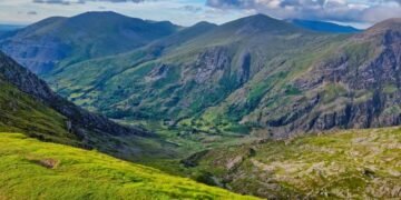
Snowdon or Yr Wyddfa in its proper Welsh is the highest mountain in Wales. It rises to 1,085 metres (3,560 feet) above sea level and is located very centrally within Snowdonia National Park now Eryri National Park, officially in North Wales.
Here‘s a little interesting fact I learned from a talkative guide at the summit cafe: ‘Yr Wyddfa’ is Old Welsh for ‘the tumulus’ or ‘burial mound’ in reference to a legend about a giant called Rhitta Gawr. Perhaps it‘s just the mythopoeic nature of the legend, but the mountain does seem to have a primeval, ominous air about it, and when the clouds descend and hide the summit in front of your eyes (oh yes, quite often)this becomes immediately apparent.
At the very top, you‘ll find:
- A stone trig point comes across as the mountain‘s finish line; also the place where everyone converts into a camera-hunting Zombie to get that compulsory team shot.
- Hafod Eryri (the summit visitor centre/ cafe (yes you really can buy a cup of tea at the top of a mountain life‘s little cheerful absurdities))
- Clear days provide the prospect over all of Wales and, given the right weather conditions; views on a clear day extend as far as Ireland, Scotland and England.
I‘m writing “on a clear day” here, because in my experience, clear days at the summit tend to be few and far between. This is the second time I have made the ascent, and in both cases the view has been from “huge dark cloud” to “honestly can‘t see my own hand”. Don‘t expect much, but it‘s always a surprise when you get any.
Snowdon: Numbers
Before we get into the routes, here‘s the snapshot version for anyone skimming:
| Fact | Detail |
| Height | 1,085 m (3,560 ft). |
| Welsh name. | Yr Wyddfa |
| Location | Eryri (Snowdonia) National Park, North Wales |
| Maximum peak in. | Wales |
| Total count of main hiking tracks | 6. A Subdivision of ‘Debt’ This counts as an item in its own right. |
| Hiking/cycling/horses/boats | For these additional popular forms of outdoor recreation, eachplace station can be provided at strategic locations, providing convenient starting points that are readily accessible from anywhere in town. As shown in Figure 5, where possible, these stationary stations should be situated on trails and other travel routes toopportunity for transportation. |
| Snowdon Mountain Railway | |
| Mean Round-trip hiking time | 6–8 hs |
| Best months to climb | May–September |
Now, let‘s move on to the steps of actually getting into the school.
The Six Ways Up Snowdon
This is the section that most searchers for “Snowdon summit” actually care about, not the trivia but the gritty “how do I not die” details. There are officially six accepted routes up Snowdon according to the guide to the Eryri National Park, each with its own wholly individual character. It can be dangerous to select the wrong one like picking a film just by its advertising!
1. Llanberis Path The Gentle Giant
Distance: Approximately 9 miles (14.5km) round trip
Difficulty: Easiest
Time: 6 hours (round trip)
This is the longest route, but it‘s also the least steep, following the route of Snowdon Mountain Railway for much of its length. It is also the most popular route of ascent: all routes combined, over 600,000 ascent to the summit of Yr Wyddfa annually. If it‘s your first big hill walk, or you‘re leading a newbie who quite sincerely believes they‘re ‘not really a hill walker’, this is the route you should start with. It‘s the ascent I completed on my first attempt and, as I discovered after some questionable weather prognostication, it was a bit of a struggle…
2. Pyg Track The Popular Middle Ground
Distance: ~7 miles (11km) roud trip
Difficulty: Moderate
Time: 6 hours round-trip
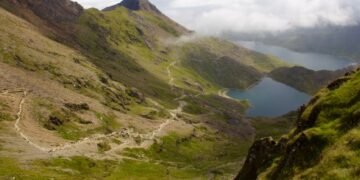
Begins at Pen-y-Pass and probably the most beautiful of the group, passing through jagged ridges to the river Llyn Llydaw, a glacial lake that appears to be a scene straight from a fantasy film. This is the trail that I would really suggest to most reasonably fit, self-sufficient hikers, as it gives a good challenge and is very rewarding.
3. Miners’ Track The Photogenic One
Distance: ~8 miles (13km) in a loop.
In case of a moderate (easier start, tougher finish) overall test, the calculation would be: Weakness of the test from a weighted perspective:
Where the function is a copy of the total test function except for the two described above in generating the overall difficulty.
Duration: 6 hours round trip
This path begins at Pen-y-Pass and begins fairly gently along an old, flat lead mining track before hitting you with a steep kick just before the end, a bit like a film that has you settle in with some slow talking before taking you on a rollercoaster right at the end. Very picturesque views of the lake.
4. Snowdon Ranger Path The Quiet Historic Route
Distance: around 8 miles (13km) round trip
Difficulty: Moderate
Time: 6 hours there and back.
A more historic route up the mountain and certainly not as busy as Pyg or Miners’. If you‘d like some peace and quiet and don‘t mind a fulfilling but none too glamorous uphill trek, this is the way to go.
5. Rhyd Ddu Path The Underrated Gem
Commute: ~8 miles (13km) total, each way
Difficulty: Moderate
Time: 6 hours RC distance (d): SouthWesterly/ (2W)(1.5 m) = 2.12, 3415 m one way. Traveling Northwest (about 270°). (Assuming it doesn‘t take me as long to travel back to the beginning of the point B trip.) PathII: (Time: 4 hours round trip125). RC distance (d) (point A to point B and back to point A): (RO) (s) traveled 3.239.
One of the more scenic and less congested routes. If you don‘t want to spend time fighting for trail space and photostops at every corner, then something to think about.
6. Watkin Path The Toughest Climb
Distance: around 8 miles (13km) all together.750mls each way.
Difficulty: Hardest
Duration: 7+ hours travel time to and from the site.
Starts low and gains the greatest elevation change of any route, ending with one of the most sublime scrambles close to the summit. This is a great choice for those who have already experienced several mountains and seek a real challenge. This is one I have not yet tried (to my own benefit).
Quick Comparison Table
| Route | Distance | Difficulty | Time | Best For |
| Llanberis Path | 9 miles is quite inaccurate 6000 miles, as the unweighted least squares regression line explained only 3032 of the variation. 9 kilometres is also an underestimate 1500 km in regards to the estimated maximum distance that the car would go, although there is more uncertainty at higher distances (see diagram). | Easiest | 6 hrs6 hours | Beginners |
| Pyg Track | 7 miles | Moderate | On six hours. | The numbers of most hikers |
| Miners’ Track | Eighty miles | Moderate | 6 hrs 6 hrs | Resource book to handouts. These may include case by case analysis that supply background and business realities. Excellent for a quick 6hr Scan. Guide is checked daily to ensure relevant date. Paper copy and online. |
| Snowdon Ranger | The disease is rising. | Moderate | 6 hrs. | -Canciones de la soledad for those who seek solitude |
| Rhyd Ddu | 8 miles | Moderate | 6 hr. | Quieter alternative |
| Watkin Path | 8 miles | Hardest | 7+ hours. (May be supplied with the software. One is supplied as part of the software.)” | Seasoned hikers |
Or, You Know… You Could Just Take the Train
Not up for an eight-mile trek? The Snowdon Mountain Railway runs directly from Llanberis to the summit no blisters needed. Established in 1896, the railway covers its 4.7 miles journey to Hafod Eryri every day, offering a rare opportunity for up-close adventure on Britain‘s only public rack-and-pinion railway. The ride, with old- fashioned carriages and fantastic scenery, is just delightful: no sore muscles tomorrow.
I‘ll also concede there‘s the odd little identity crisis that arises when you have just spent the last six hours grinding your guts out trying to climb a mountain and a train full of happy hikers in flip-flops whizzes past you – up the mountain and looking supremely content. No shame with the train though. Not everyone wants to (or physically can) hike and the view from the top is still good.
What My First Climb Actually Taught Me
Be honest here, as most articles you read about hiking Snowdon make it appear like a nice walk with a good pay off at the end. It can be. It also can go wrong very quickly if you‘re unprepared. During my first attempt, three things happened that I now regard as compulsory learning points for your own trip:
- Changing weather quite rapidly, it is “deranged” the weathers so rapidly. We began in perfect sun shine and on the Outward Hut arriving we had descended into total cloud to a point that we could see maybe 20metres as for Snowdon he has his fresh microclimate yet again what appears as a blue skye is not when we are 300metres up.
- Cotton is terrible. It became saturated with my sweat, then dropped in temperature, and I had been for the last 2 hours was essentially just a cold wet rag against my skin. Moisture-wicking layers are not just a popular gimmick in-brand hiking marketing, they work.
- People get injured descending, not climbing. The vast majority of attention is given to the ascent. If you think about it, people fall and injure themselves on the downhill far more frequently than on the climb. Whether you want to view it as running a marathon or a free climb, the last few miles when you‘re hit the wall are when you‘re most liable to blow out a knee. Treat the descent just as carefully as the ascent.
Practical Tips Before You Go
A few things I‘d tell a friend before they attempted this:
- Use the Met Office mountain weather forecast for Eryri/Snowdonia rather than the regional forecast. Mountain weather is a different kettle of fish.
- Start early. Car parks are very full, particularly at Pen-y-Pass, and if you start later you‘ll finish later which could be in the dark.
- Bring layers, always, even in the summer. Can‘t afford waterproofs? There‘s no choice.
- Bring extra water than you think you‘ll require. You can‘t top up your supplies once you‘re on the footpath (other than the summit café, which also can‘t be depended upon to be open, let alone be in the right place when it is).
- Heavily worn in boots. Not the cheap ones you got 3 days ago because “I mean what‘s the difference, right” (ahem, yes I did do this and no, I do not advise it).
- Know your route‘s level of difficulty realistically, not aspirational. Choosing Watkin Path as your very first mountain walk is like attempting a marathon for your first run.
Is Snowdon Difficult to Get to the Top?
Short answer: this is really a very open question and depend on what route you do and how fit you are. However, as there is no “easy” route other than walking in the park in Snowdon, any route from the south will involve covering just under 1000 metres of ascent over a few hours. If you‘re fairly fit, reasonably quick and just plod slowly up this is well manageable for most healthy adults. However, it is an actual hike, and not at all a stroll.
How long will it take to climb Snowdon?
Most trails are around 6-7 hours round trip (including breaks for the car, breaks for photos, that one time near the top where you will absolutely stop to get your breath, and to contemplate your existence) while considering possible steep sections the Watkin Path can be quite a bit longer- 7-8 hours.
Can you actually make it to the summit of Snowdon?
No it all adds up to no acces s to the top. The only alternative to walking was the Snowdon Mountain Railway from Llanberis.
Trusted Resources for Planning Your Climb
Before you set off, it‘s probably worth making a list of few authoratitive sites to check into rather than risking too much attention on a blog post (including…!):
- Eryri National Park Authority : the current official authority for the mountain, providing current maps and advice on the routes, safety, and parking.
- Snowdon Mountain Railway : Snowdon Mountain Railway is the operator of the official railway: with information, timetables, prices and season dates.
Final Thoughts From Someone Who‘s Been There
Climbing Snowdon summit is not simply about ticking off the highest point for the sake of it, that was not how I saw it. In fact, for me at least, climbing mountains is about the feeling of being away from it all, out in the elements, impacting hours and endless miles until the world around me is a patchwork of green and grey until, if you are lucky, you reach a height where the view makes every second of hard work worth it. And if not? You know you have not wasted anything.
If I were to go back and have a chat with my first timer self, this is what I would say: No, it isn‘t a walk in the park, No, it isn‘t an easy day out, and No, you shouldn‘t wear cotton. Apart from that enjoy it. Snowdon both humble and reward you, all in one six hour run, and frankly, this is why we do it.
No matter which path you decide to take and no matter how the elements assault you, you‘ll have a story to tell. As for me, mine includes a soggy t-shirt and a cup of tea at the summit that tasted better than most tea has any business tasting. Hopefully yours will be equally legendary sans the cotton shirt of course.